Where is Milwaukee County’s Remotest Point?
April 10, 2025 | Topics: Places, Stories
By John Johnson
With an introduction and photography by Eddee Daniel
I have long been captivated by the idea of “urban wilderness” and the feeling one can have in certain places, even within cities like Milwaukee, of being in a remote natural setting. I seek them out and very much enjoy the ones I find. When I met John Johnson—fittingly, perhaps, on the top of the new observation tower in Washington Park during the grand re-opening of the Urban Ecology Center there—and he told me about his project to find the remotest point in Milwaukee County, I was enthralled.
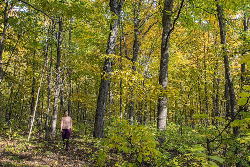
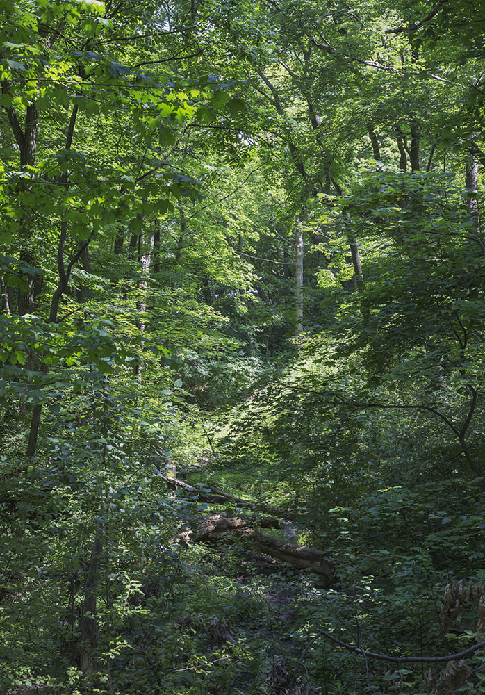
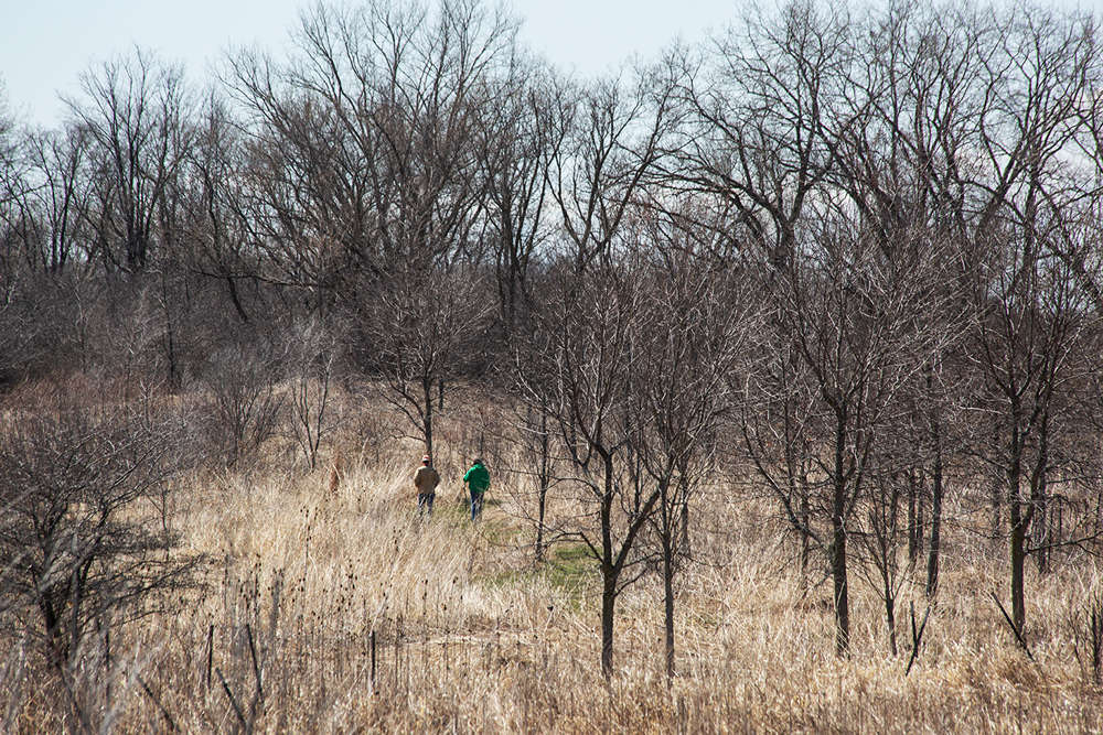
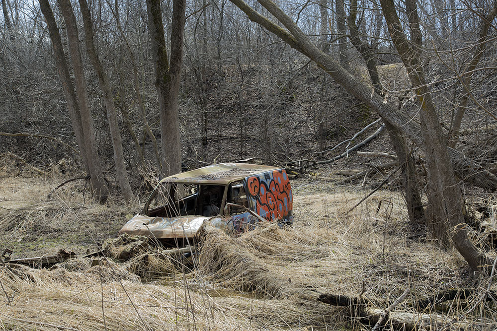
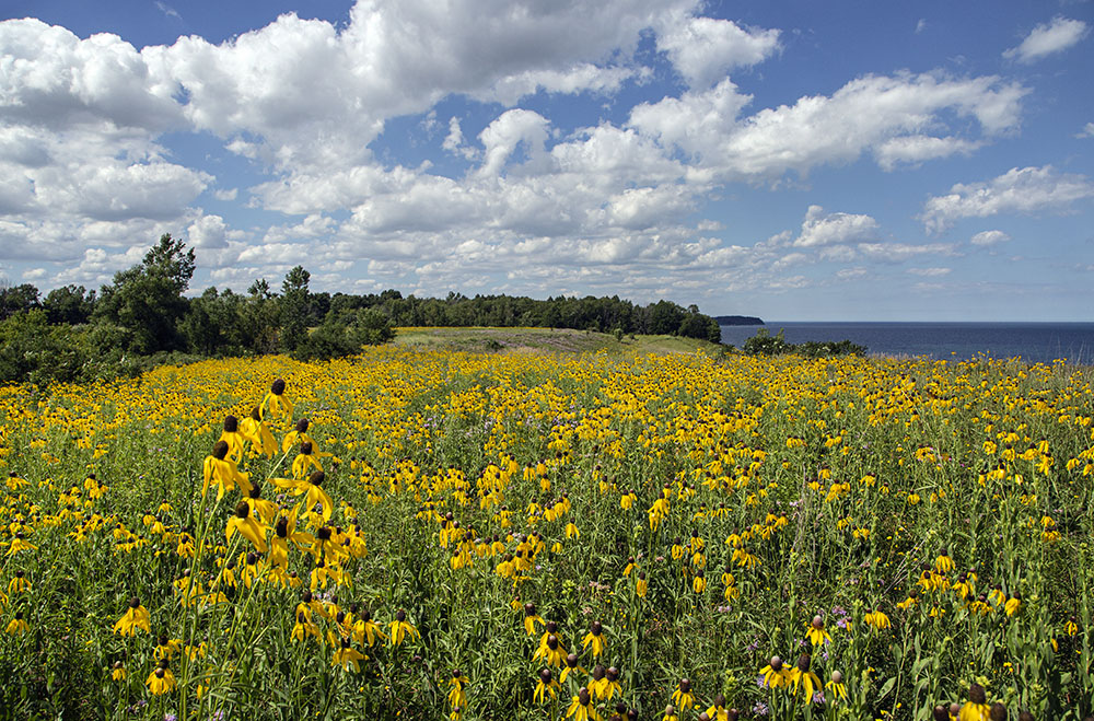
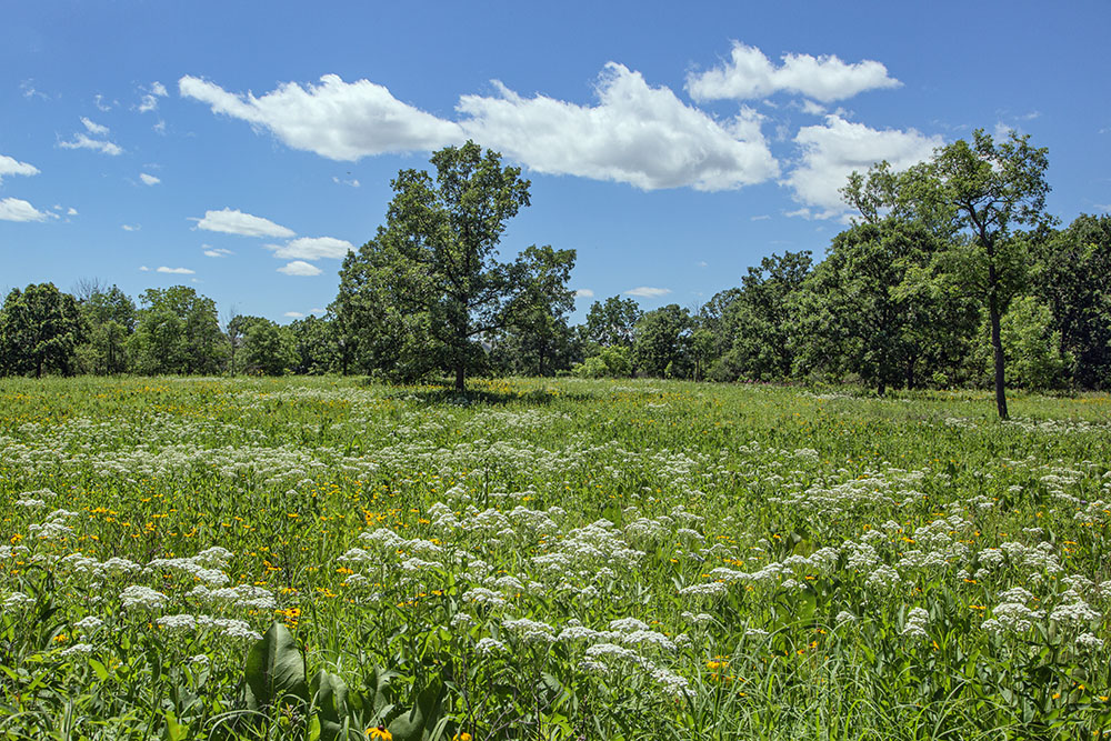
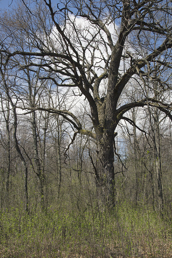
The story he sent is as fascinating as I expected. It isn’t long, however, and, for reasons that will be apparent when you see his single photo of the site, short on imagery. Therefore, I have created a photo essay to accompany it. The photos I’ve selected are from places in Milwaukee County that I have found that feel remote, even though they do not meet the requirement of actually being farthest from a road.
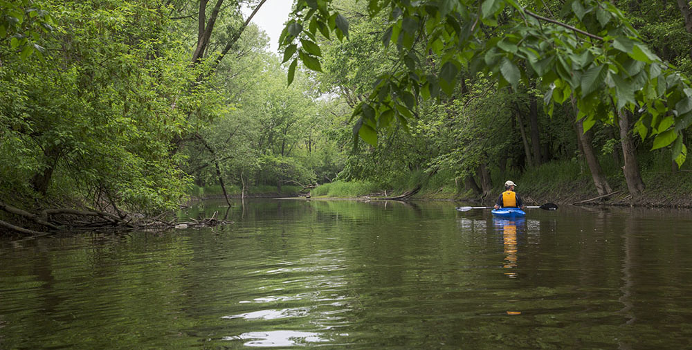
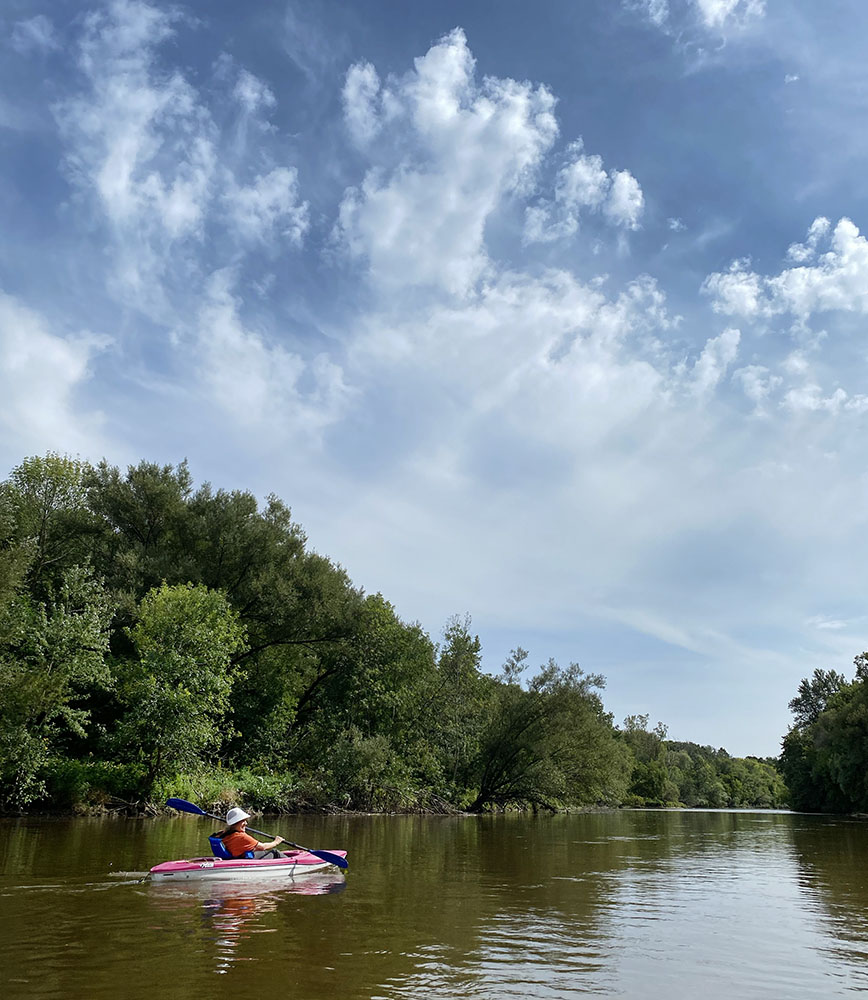
So, no, the photo above of the kayaker was not taken at John’s remotest point. It is the Menomonee River in the Menomonee River Parkway. Looks pretty wild, doesn’t it? While that’s the result of equal parts illusion, imagination, and wishful thinking, the feeling of being remote was real enough at the time.
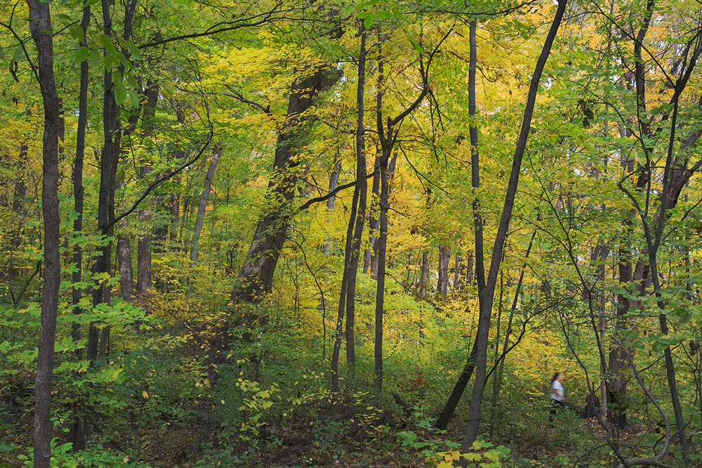
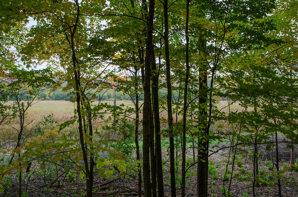
Likewise for the next photo and each of the places in the photo essay that follows John’s story. I’m afraid it will be a bit of a teaser because, except for brief captions, I’m not taking the time to explain the reasons for each selection. That would take an entire blog post. (Watch for it!) I have written previous posts about some of them, in which case I’ve included a link to the story. In any case, though, there is a link to our Find-a-Park page for more information.
~ Eddee Daniel
Where is Milwaukee County’s Remotest Point?
By John Johnson
The farthest one can travel from a road in Milwaukee County is 786 meters, or just under half a mile. Whether this seems a large or small number, I leave to your judgment. When I visited this point with a few friends on a bright January morning, we never fully escaped the sound of passing cars. With every particularly noisy reminder, someone would jokingly complain, “I thought you said this was far from a road,” to which I would argue that the word farthest implies nothing about absolute distance.
To me, it’s remarkable that such a (debatably) remote point exists at all in Milwaukee, the only county in Wisconsin where not a single acre remains unincorporated. By my calculations, there are about 3,900 uniquely-named roads in Milwaukee County covering roughly 4,000 linear miles. 786 meters is almost precisely the distance from City Hall to the Milwaukee Art Museum. Imagine standing on a point with not a single bit of pavement—or human structure—within that distance of you in any direction.
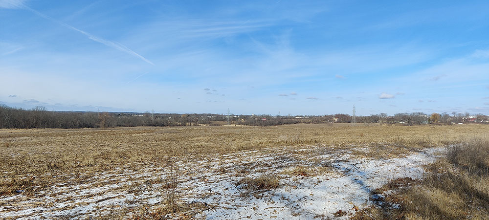
In this instance, you should be imagining yourself standing on the edge of a farm field, because that is where Milwaukee County’s remotest point falls—a cornfield owned by the Parks Department. The field is in Franklin, exactly halfway between Oakwood and County Line roads, roughly on line with South 42nd street, if it extended that far south, which it doesn’t.
To reach our point, a forester friend and I parked in the empty Oakwood Golf Course parking lot and walked west on Oakwood Road. Despite its generally rural aspect, the road is punctuated at regular intervals by shiny fire hydrants, installed, perhaps, in anticipation of future development. Plunging into a field, we followed a little-used farmer’s two-track path around the edge of one field, across a waterway, and through a second. We then entered a third field and followed a hedgerow all the way to our destination.
We stood on the edge of a southern mesic forest of mainly maple, hickory, and cherry, with a prickly ash understory. It had been lightly logged at some point in the last couple decades and competition for the exposed sky was fierce between the more mature stands. My forester friend, whom I owe for these botanical observations, speculated that someone tried to harvest the ash before the emerald ash borers got to it.
West of the forest, the farm field fell in a shallow descent toward the floodplain of the Root River, flowing on its way to Racine and Lake Michigan. It appears the most recent cultivation of this field has followed no-till practices.
All of the fields we passed through are part of a 3.3-square mile contiguous swathe of county park land in the southwestern quadrant of the county. Little of it is developed into official parks and more than a few acres remain cultivated farmland.
My understanding is that Milwaukee County Parks acquired these lands as part of its long-range Park and Open Space Plan. A key component of this Plan was to identify land with quality natural resource features and potential sites for the development of new parks. The County utilized funding from Federal, State and local programs to purchase and develop land throughout the County as they became available. Some properties were donated by generous citizens. Many of the parcels acquired were being used for agriculture, particularly here in the southern parts of the County. Undeveloped agricultural land is leased to farmers to help with the stewardship of these areas, for example as erosion and weed control. It also has the added benefits of increasing food production and generating some income until the Parks Department has the opportunity to develop them according to the Plan.
Shortly after my visit, UrbanMilwaukee reported that the county had indeed received a federal grant funding the restoration back to prairies and wetlands of the very fields I walked through. Given the uncertainty around federal grants, I do not know if this specific project will come to pass as scheduled. Still, the plan is a good one. Milwaukee’s remotest point is beautiful even as a stubbly field, but I hope to see prairie flowers there instead one day. Sometimes conservation, I reflected on that hike, includes setting aside land in the faith that future generations will better know what to do with it.
Data note: Finding the remotest point in Milwaukee County is part of a project to find the remotest point in every county in Wisconsin. Thoughtful readers may object that the farthest point from a road in Milwaukee County is surely in Lake Michigan. This is true. Technically, the county extends all the way to the middle of the lake. To avoid this boring conclusion, I have excluded the Great Lakes from my calculations. To find each county’s remotest point, I first obtained GIS data covering every motor vehicle accessible road from OpenStreetMaps. Then, I buffered each of these road lines by 500m on each side, and subtracted this buffer from the shape of Wisconsin. The remaining polygons represent areas at least 500m from any road. I then calculated each polygon’s farthest interior point by finding the radius and center of the polygon’s maximum inscribed circle.
Photo essay: Where in Milwaukee County can it feel remote?
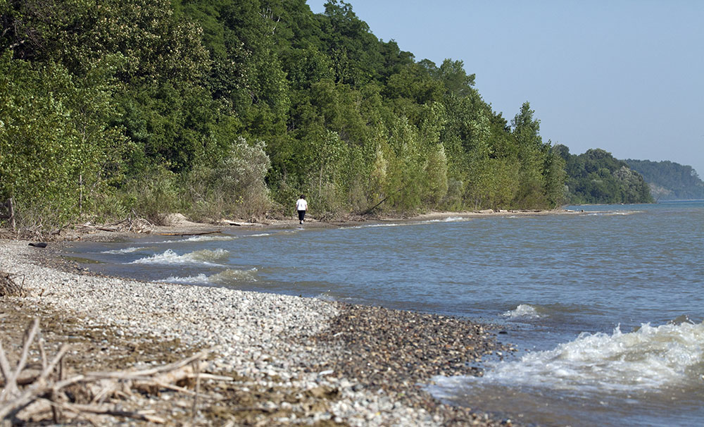
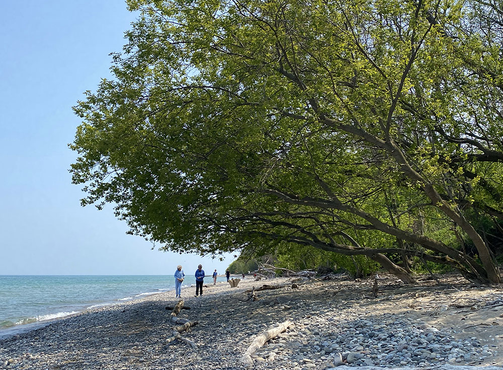
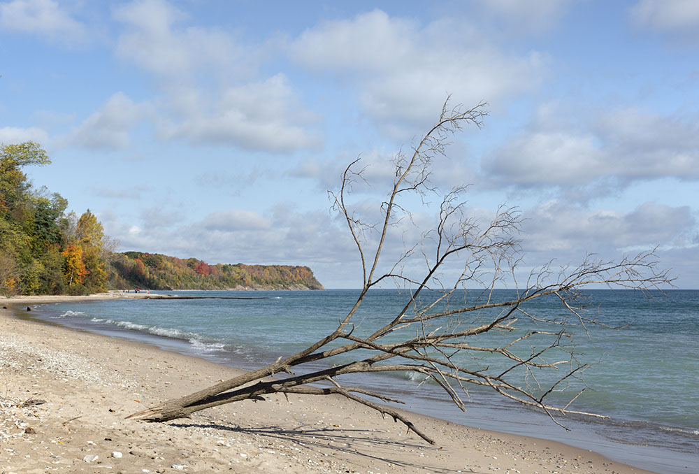
At least three beaches along the shores of Lake Michigan have the strategic advantage of steep bluffs that protect visitors from the commotion of the urban area above them, making them especially secluded. If you really want to “get away from it all” without leaving Milwaukee County, any of these will do. See if you can identify each of them before looking at the captions.
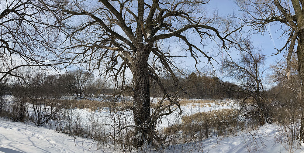
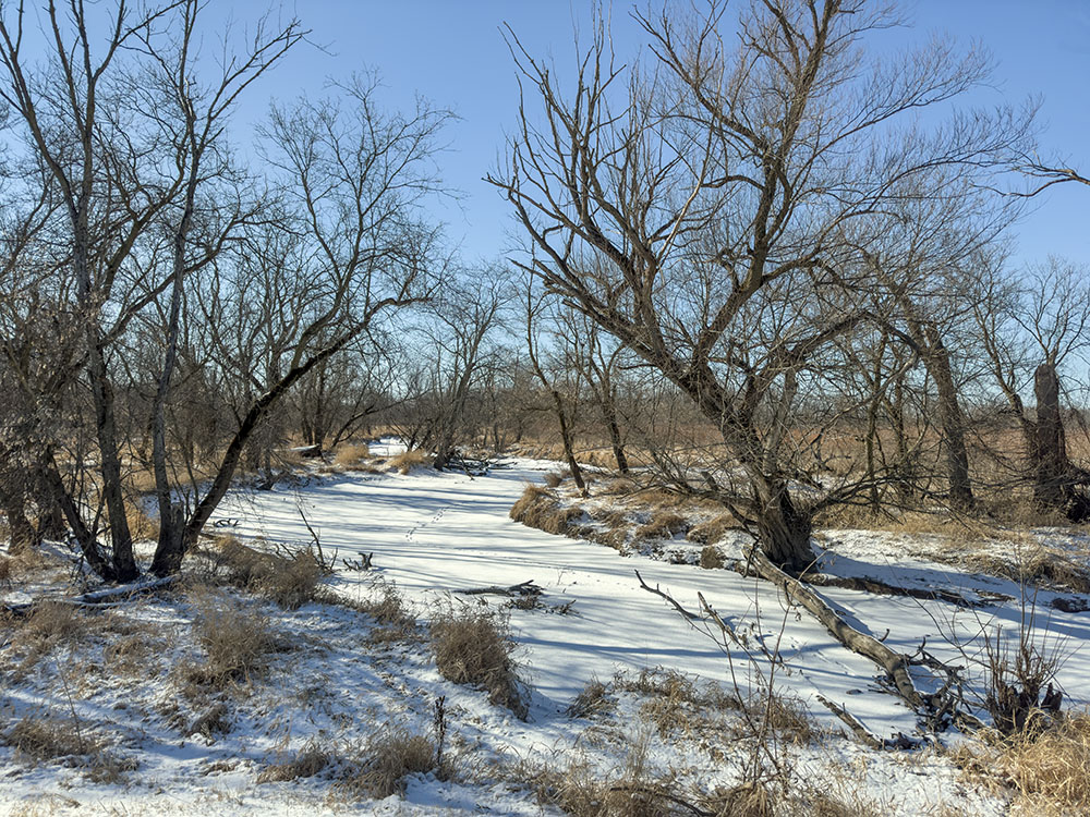
In conclusion, I was not surprised that John found the remotest point in the Root River Parkway, which is roughly 15 miles long and by far the largest piece of the Milwaukee County Park System. As he indicated, a significant portion of it is as yet undeveloped as parkland. Coincidentally, during one of the brief cold spells this winter I went for a walk on the frozen Root River not far from John’s remotest point. Since there are no trails there (yet), the river was the easiest way to travel!
Related stories:
Parks Awards Contract for Franklin Habitat Restoration Project (Urban Milwaukee)
“Wildest Dreams” from the urban wilderness along the Menomonee River
The constant lure of adventure: Kayaking a surprisingly wild urban river
Honey Creek Wildlife Area: A Winter Wilderness Revealed
Jackson Marsh Wildlife Area: Degrees of Wilderness … and Solitude
John Johnson lives in Milwaukee’s Washington Heights neighborhood, where he’s an avid bicyclist and enjoyer of local parks large and small. By day, he’s a research fellow at the Marquette University Law School, studying housing, demographics, and politics in Wisconsin. Website: https://johndjohnson.info/.
All photographs by Eddee Daniel, except as noted. Eddee Daniel is a board member of Preserve Our Parks, author of Urban Wilderness: Exploring a Metropolitan Watershed, and an avid explorer of the urban wilderness wherever he can find it.
4 thoughts on "Where is Milwaukee County’s Remotest Point?"
Comments are closed.
I found this post, absolutely fascinating both for what john has discovered about the remote point in the county, but especially your selection of remote spots with gorgeous photographs of each that entice of viewer to want to visit each of them.
Greetings! Very useful advice within this article!
It’s the little changes which will make the most significant changes.
Thanks for sharing!
First of all I would like to say fantastic blog!
I had a quick question which I’d like to ask if you do not
mind. I was interested to find out how you center yourself and clear your thoughts before writing.
I’ve had difficulty clearing my thoughts in getting my thoughts out.
I truly do take pleasure in writing but it just seems like the
first 10 to 15 minutes are usually wasted just trying to figure out how to begin. Any ideas or tips?
Kudos!
I’m afraid I don’t have any routines to recommend. Most of the time I write when inspired by something and the story takes hold of me.