Celebrating the Ice Age Trail in Southeastern Wisconsin!
December 11, 2023 | Topics: Places, Spotlight
By Eddee Daniel
If you know what a moraine is, or if you know that a kettle can be a landform in addition to a kitchen item for steeping tea, chances are you live in Wisconsin. The impact of glaciers on the land is evident here like few other places on Earth. And we Wisconsinites are fortunate. We have the nation’s only National Scenic Trail that is entirely within one state. For 1,200 miles, the Ice Age Trail follows the line of the terminal moraines and other topographic features left behind by the receding glaciers.
Like the other National Scenic Trails, the Ice Age Trail is a magnet for long-distance hikers. However, most people who enjoy the Trail take shorter hikes along portions of it, like me. Fortunately, the Trail is broken up into manageable Segments that can be completed in a single day or less. Even an hour or two on nearly any Segment will convince you that we are blessed with something quite special.
After many years of enjoying the Trail in this fashion, mostly returning the same favorite Segments over and over, I decided this year to explore as many nearby Segments as possible and to share what I discovered with my camera along the way. I was preparing this post when, coincidentally, my online news feed brought me the announcement this morning (Mke Journal Sentinel, Dec 7, 2023) that the Ice Age Trail has officially been made part of the National Park System. (I must admit that I thought it already was; there has been a page on the NPS website for the Trail for some time.)
And so, to celebrate the new designation, I bring you a photo essay from sixteen official Segments and a few sub-segments, all located in southeast Wisconsin within an hour’s drive from Milwaukee. This is not intended to be a guide, however, links to the excellent Ice Age Trail Guidebook maps are provided for each Segment.
In order to include so many, I’ve had to limit myself to one photo per Segment, which is inadequate to convey the beauty and variability of the terrain and other natural features. To compensate, for anyone who wishes to see more, I’ve created a Flickr album with additional photos from each of the Segments.
So, let’s take a tour, beginning in the Northern Unit of the Kettle Moraine State Forest and proceeding southwards.
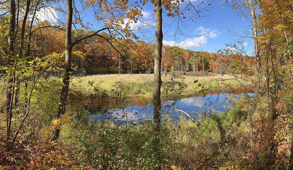
The blue of Butler Lake is visible through the splendor of autumn maples. Parnell Segment, 13.9 mi, located within the Kettle Moraine State Forest – Northern Unit. Other points of interest are the Parnell Tower and a striking collection of kames and drumlins.
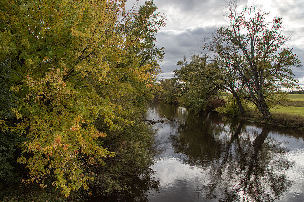
The Milwaukee River at the Hwy H bridge crossing. Milwaukee River Segment, 11.2 mi. From here the trail runs north through the rugged, hummocky terrain of the southern end of the Northern Unit of the Kettle Moraine State Forest and south along the river. (See story.)
Aerial view of the Ice Age Trail heading into the Otten Preserve from the trailhead at Ridge Road. Although this section of the Kewaskum Segment is only 1.1 miles, the preserve offers an additional 2.5 miles of looping trails.
A side trail running parallel to the main Ice Age Trail runs along the edge of this large kettle gloriously decked out in autumn colors. This northern half of the West Bend Segment running the length of Glacial Blue Hills Recreation Area is separated from the southern half by Hwy 33 and a half-mile stretch of sidewalk.
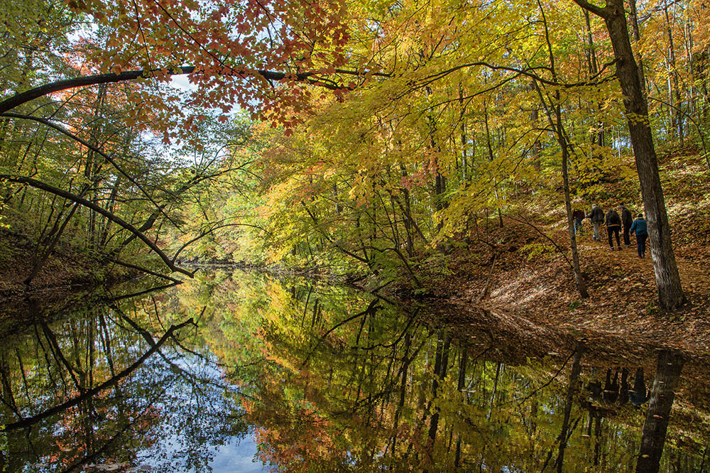
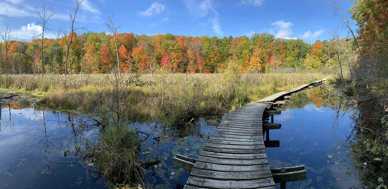
A stunning stretch of the Trail in Ridge Run Park skirts Silver Creek, which is divided by dams into two long, thin ponds. The banner photo at the top is also from Ridge Run Park. Sadly, the boardwalk was closed due to disrepair the last time I visited; the Trail detoured around it. This southern half of the West Bend Segment continues south to Paradise Drive. Total: 6.7 mi. (See story.)
The trail runs past one of several kames in the Cedar Lakes – Polk Kames Segment; 2.8 mi. Although a beautiful stretch in any season, the kames are easiest to make out in winter after the foliage has dropped.
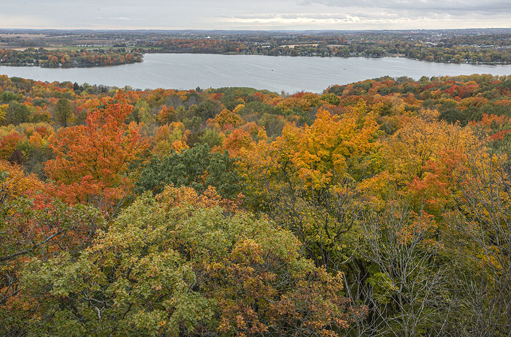
View of Pike Lake from the Powder Hill Tower. A spur trail leads to 1,350 ft Powder Hill, one of the larger kames in the region; the tower offers spectacular 360° views. Pike Lake Segment in the Kettle Moraine State Forest – Pike Lake Unit; 3.3 mi. (See story.)
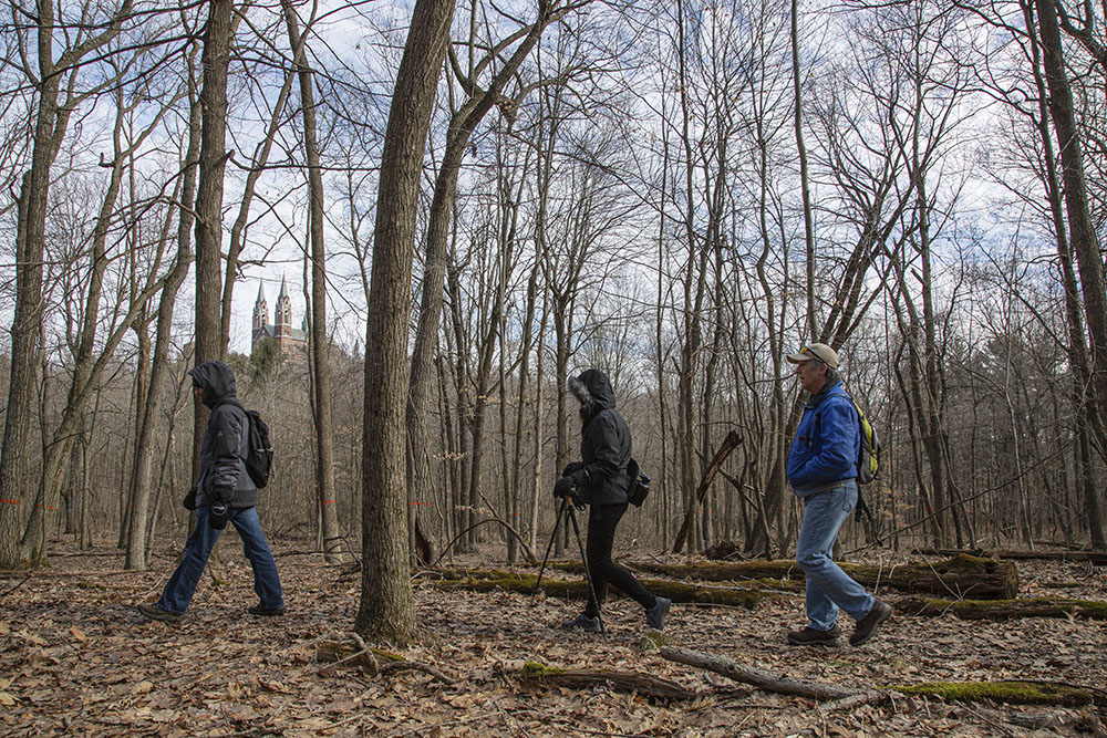
A trio of hikers on the Ice Age Trail in view of the famous shrine and monastery commanding the top of a large glacial kame, which gives it the name Holy Hill Segment; 6.9 mi. While the Trail curves almost all the way around it, the shrine is rarely visible when the trees are in full foliage.
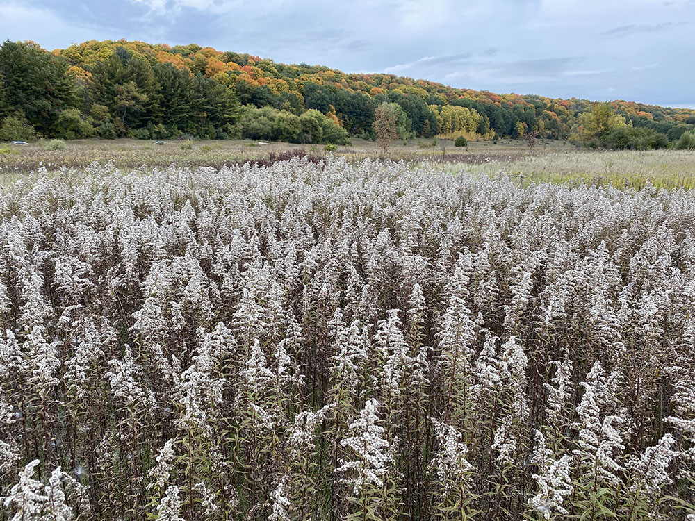
A sea of goldenrod gone to seed in a large meadow. The Loew Lake Segment, 4.9 mi, largely follows the Oconomowoc River, although the river and Loew Lake itself are visible only briefly along the way.
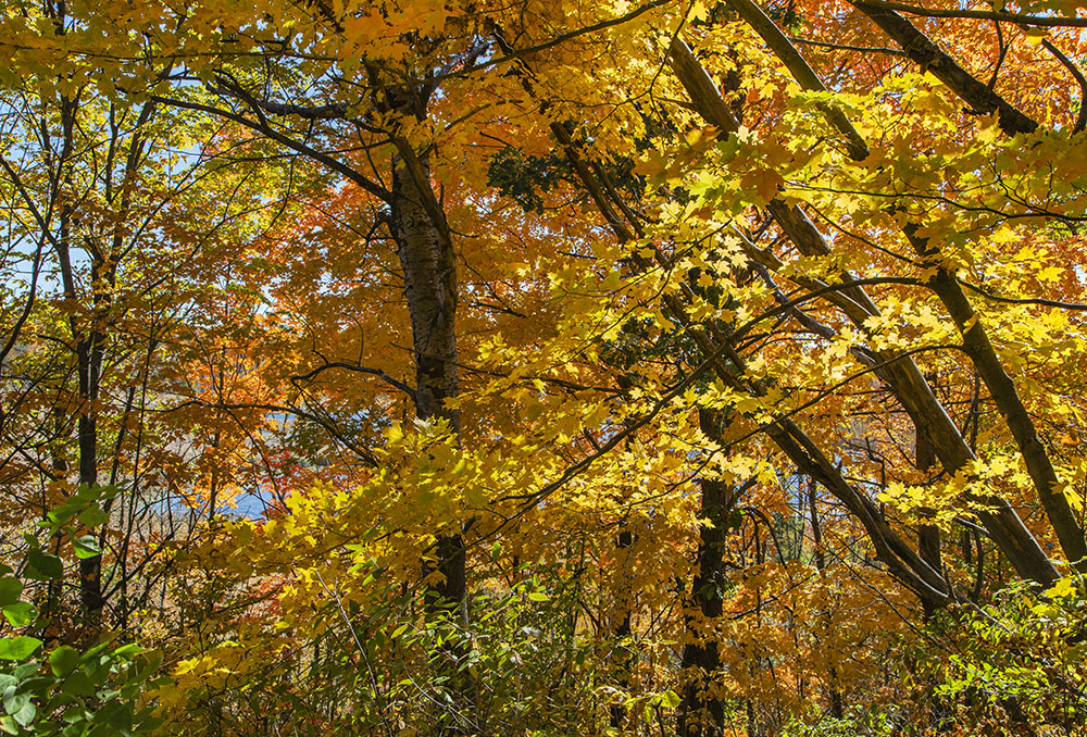
A cathedral-like canopy over the Ice Age Trail. Monches Segment; 3.1 mi. The trail here parallels and, at one point, crosses the Oconomowoc River. The mature maple forest is beautiful in any season, but most stunning in autumn.
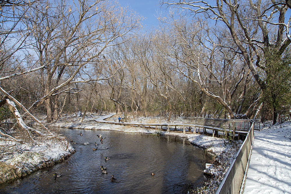
Toddler on Trail! An Ice Age Trail boardwalk along the Bark River north of Hwy 16 and Hartbrook Park. In the middle of one of the most densely developed counties along its 1,200 miles, the Hartland Segment of the Ice Age Trail has several distinct sections, connected by links along streets and sidewalks. This stretch, squeezed between the Bark River and a residential subdivision, is one of the few that are paved.
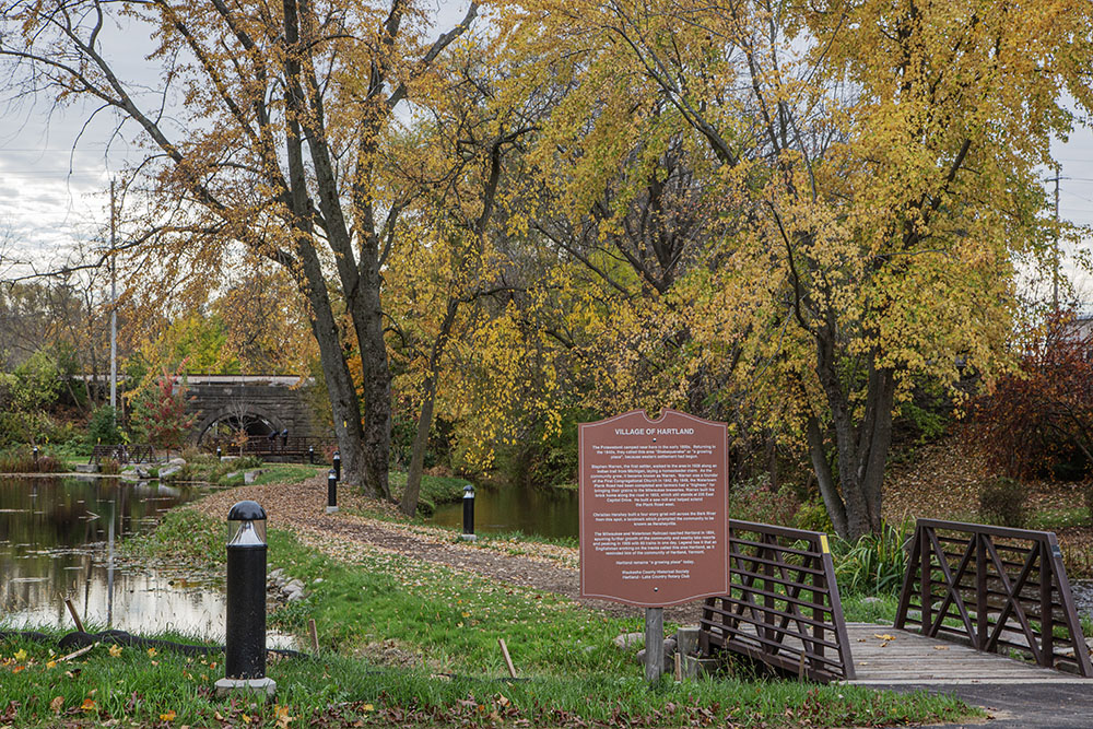
South of Hwy 16 the Trail runs right through the middle of downtown Hartland on village streets. Here in Nixon Park, developed primarily for recreation, there is a short, almost symbolic, section of the Ice Age Trail immediately adjacent to the creek-like Bark River, which runs along the edge of the park.
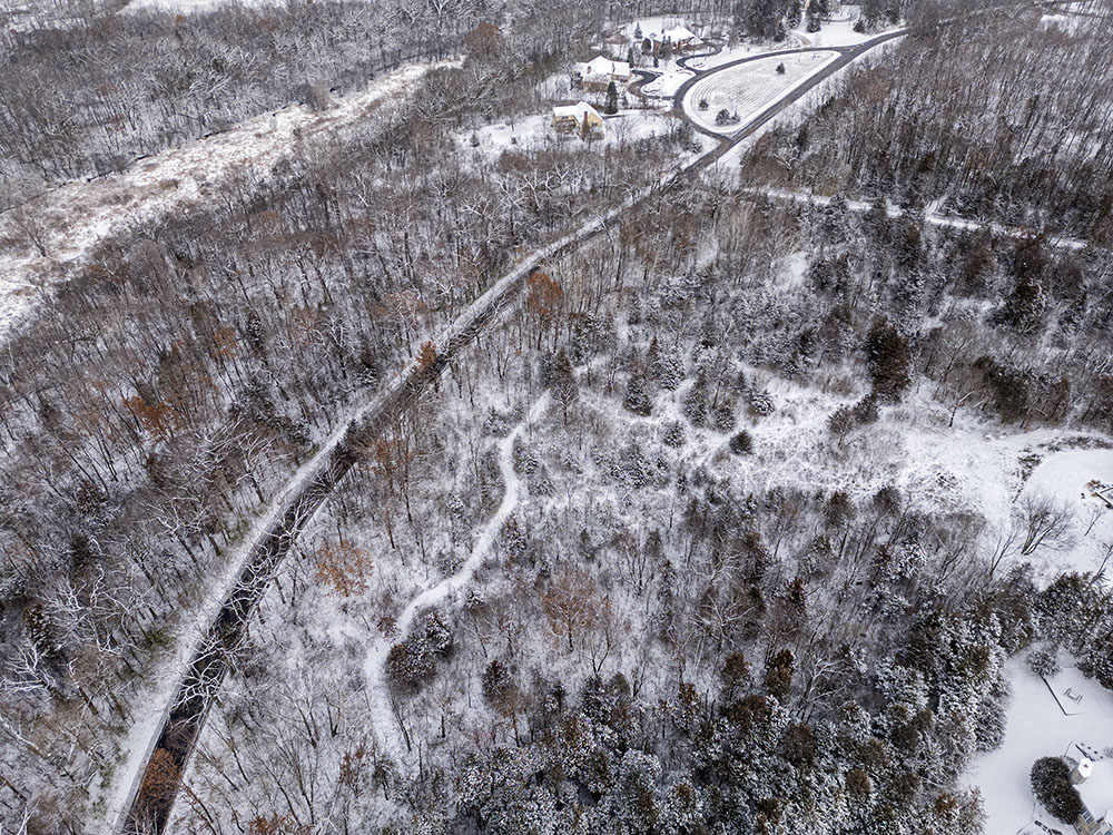
An aerial view of the Aldo Leopold Overlook section of the Hartland Segment. This marshland is adjacent to Hartland Marsh Preserve, which contains boardwalks and a lovely loop trail across two islands in the marsh. Total length of Hartland Segment, 6.8 mi. (See story.)
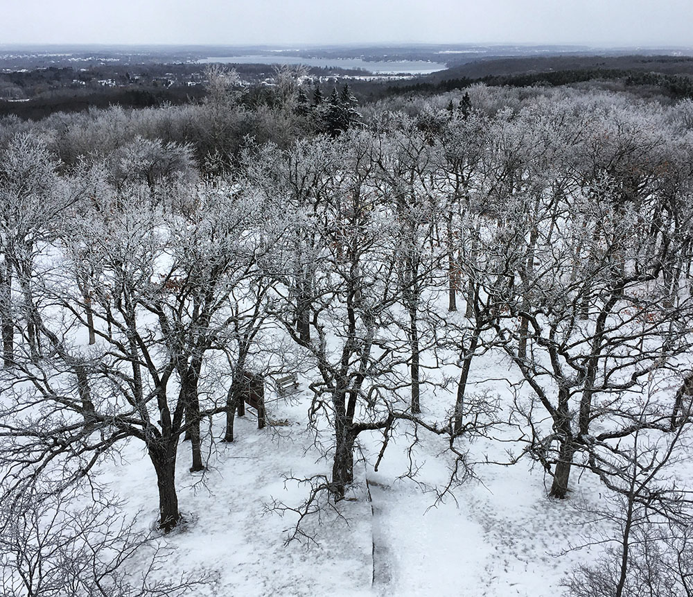
The view north from the tower atop 1,223-ft Lapham Peak, a glacial kame and the highest point in Waukesha County. The Lapham Peak Segment runs through this 1,000-acre unit of the Kettle Moraine State Forest, which has numerous other trails as well as camping and other amenities.
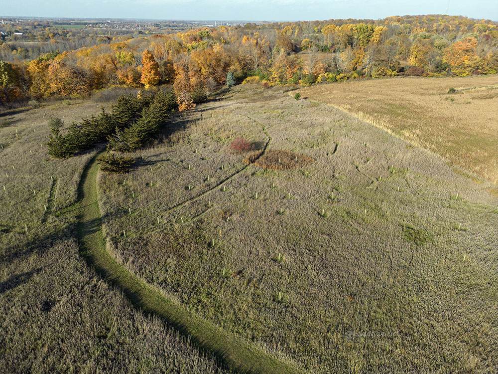
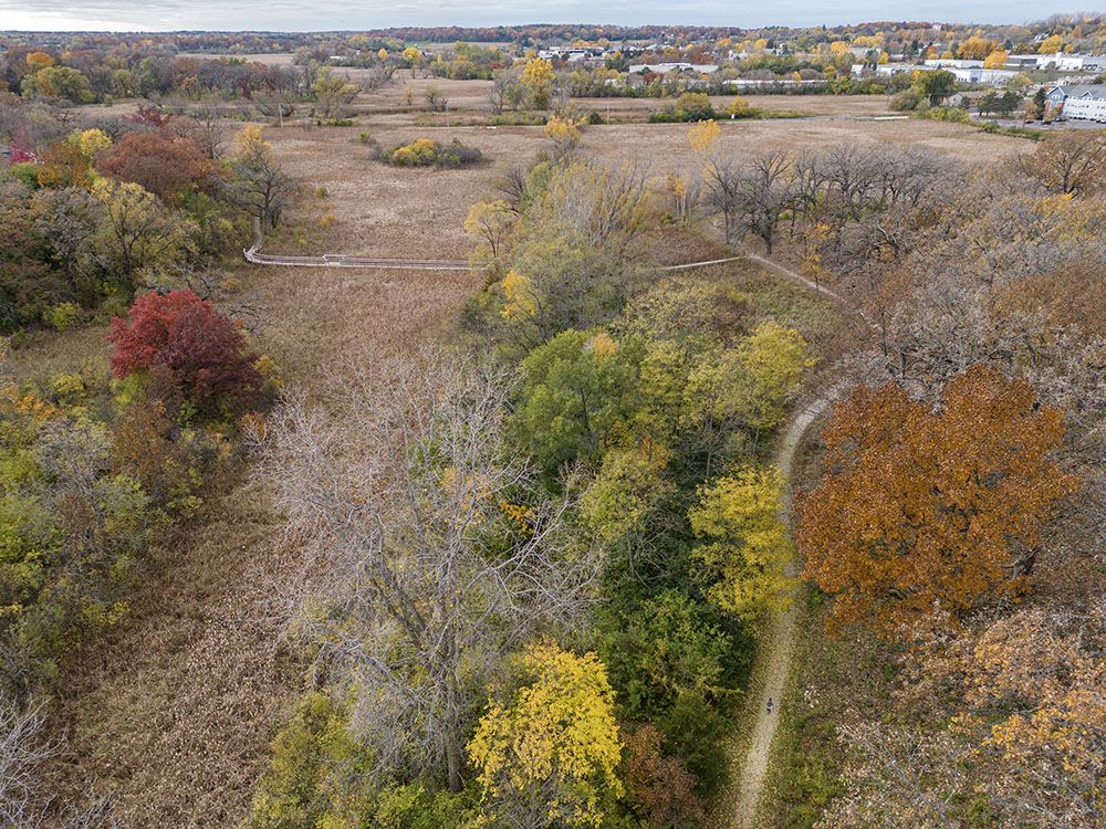
Aerial view showing the Ice Age Trail as it snakes between Manor House Road and a residential subdivision in the Waterville Segment; 3.9 mi. The gently rolling terrain is less rugged than other segments in Waukesha County that run through the Kettle Moraine. (See story.)
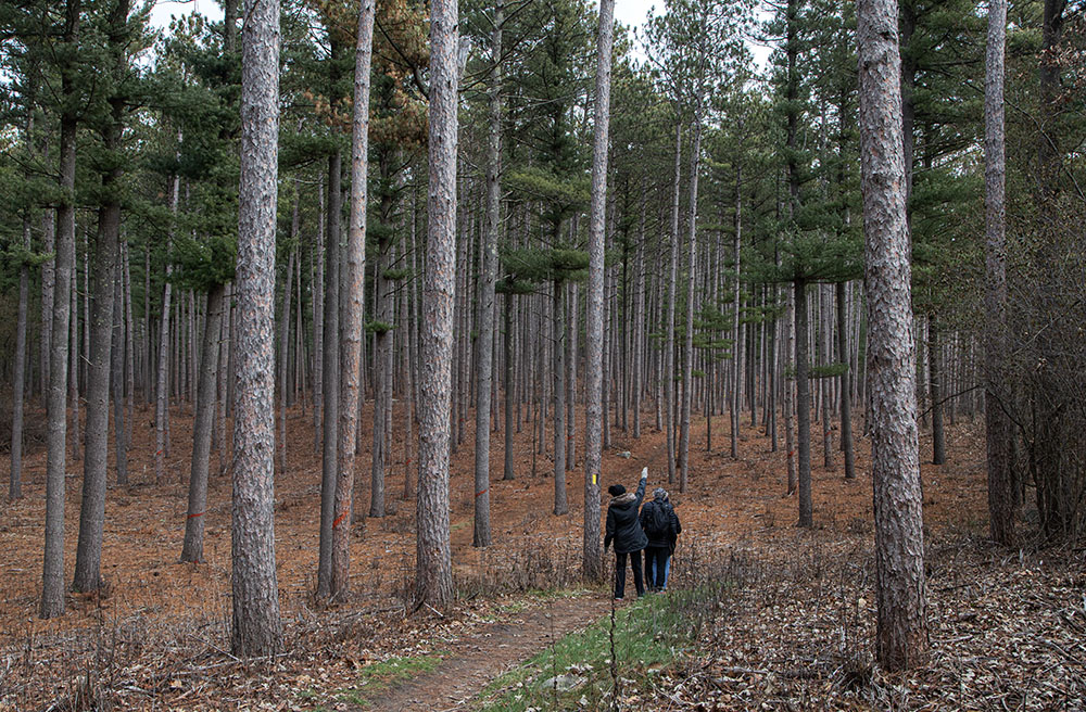
The Ice Age Trail runs through a red pine plantation in the Southern Unit of the Kettle Moraine State Forest. The 5.6-mi Scuppernong Segment is one of four in the sprawling 22,000-acre park; some portions of it plunge into and climb out of a roller coaster of kettles and ridges.
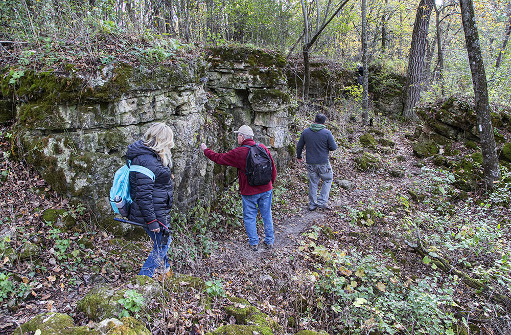
Hikers pause to admire the Brady’s Rocks outcropping, the southernmost exposure of the Niagara Escarpment that begins in New York State, encircles Lakes Huron and Michigan, and enters Wisconsin through Door County (see story). Eagle Segment; 5.6 mi.
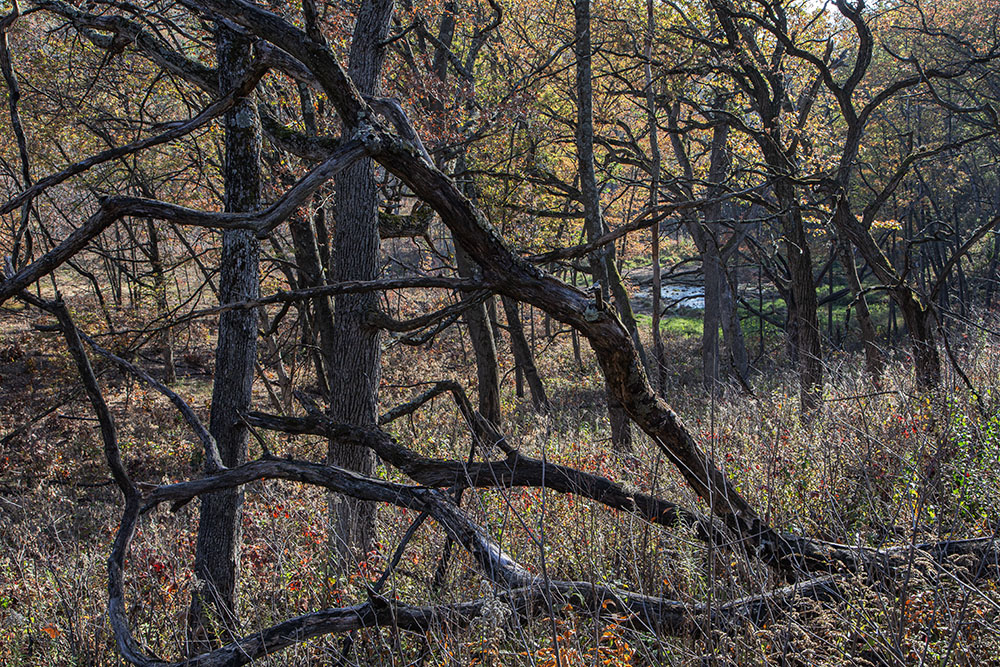
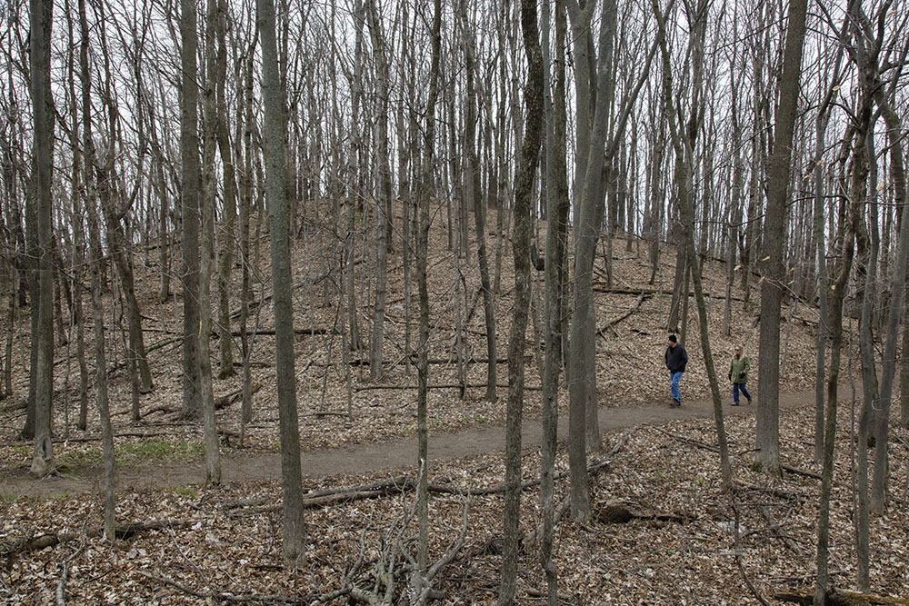
A small kettle pond visible through rhythmic tangles of fallen trees along the slope of the Stony Ridge that gives this segment its name. 3.1 mi. A little farther along the Trail is a much larger kettle and the headquarters of the Kettle Moraine State Forest – Southern Unit.
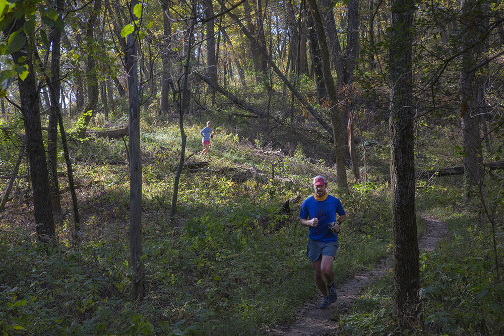
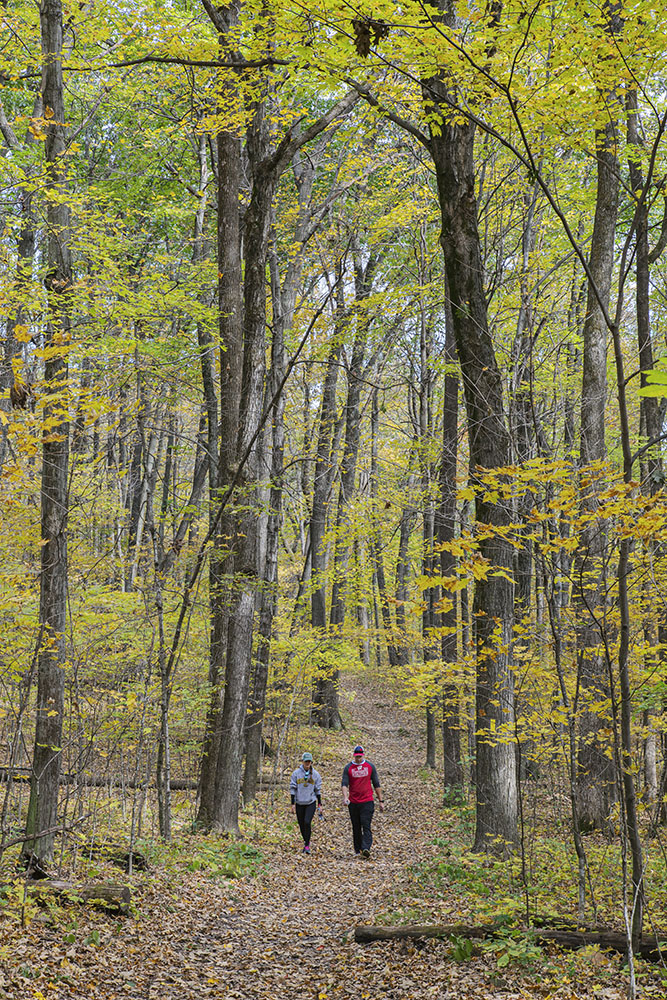
The afternoon sun spotlights a pair of joggers on the Blue Spring Lake Segment; 7.1 mi. Enjoy panoramic views from Bald Bluff and, down a short spur trail, the massive and distinctive glacial erratic known as the Stone Elephant on this segment.
To see more photos from the Segments included in this post go to my Flickr album.
For more information about and maps of the entire Ice Age Trail:
For more information about the NPS announcement:
Ice Age Trail becomes part of the National Parks Service….
Related Ice Age Trail stories:
Ridge Run Park—A Glacial Wonderland in All Seasons!
Autumn Splendor on the Ice Age Trail – Milwaukee River Segment!
The Ice Age Trail – Waterville Segment to be improved!
Hiking Hartland Marsh and the Ice Age Trail
Hiking with the Ice Age Trail Alliance (Devil’s Lake, Baraboo, and John Muir Segments)
Eddee Daniel is a board member of Preserve Our Parks and a member of the Ice Age Trail Alliance.
5 thoughts on "Celebrating the Ice Age Trail in Southeastern Wisconsin!"
Comments are closed.
Thanks for the lovely photos. I have hiked all of those segments, some twice, and enjoyed the visual reminder of how fortunate we are to have this trail preserved.
Beautiful work. As always.
Living in Hartland, I’ve been fortunate to walk some of these trails. It’s truly a gem.
Eddee, A nice survey and excellent photos — an invitation to return to trails enjoyed.
Been there😉