New section of Ice Age Trail now open in Washington County!
October 8, 2025 | Topics: Places, Stories
By Eddee Daniel
It might have seemed like a miracle. A trail appeared in the wilderness. If I hadn’t been there over the four days of its construction to witness all the work by so many volunteers…; if I had seen beforehand the many tangles of underbrush, logs and whole trees to clamber over or around, gullies to scramble across … and then returned four days later to find a beautifully finished, easy to navigate trail…; well, it would have seemed a miracle. Walking on it afterwards the trail seems almost inevitable, a natural part of the landscape.
But, of course, it was neither inevitable nor a miracle. It is thanks to the work of the Ice Age Trail Alliance and a remarkable 150 volunteers that the Ice Age National Scenic Trail just got a little more complete.
For the uninitiated, although Wisconsin’s premier hiking trail cuts a circuitous 1,200-mile path through much of the state, it is discontinuous. Through-hikers—those going its entire length—must walk along connecting roads in places to get between segments of the trail. Until now, hikers faced a 5.3-mile road walk to go from the Polk Kames portion of the Cedar Lakes Segment near Slinger to the West Bend Segment. The new trail, in two separate sections, makes that walk both safer and far more enjoyable.
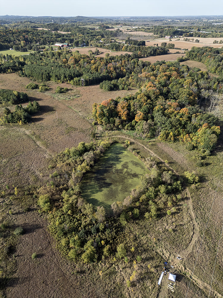
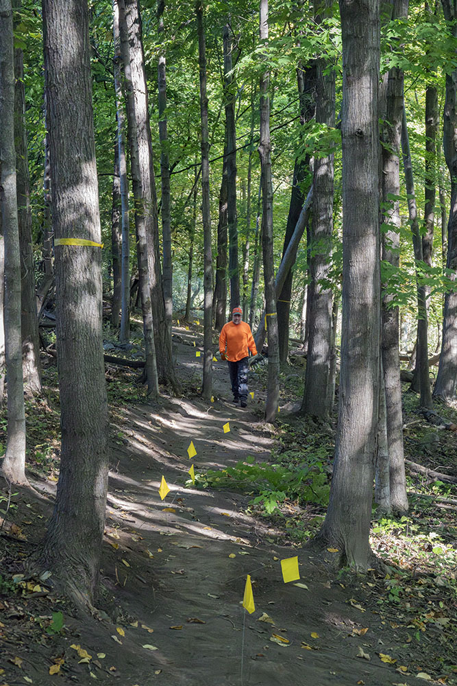
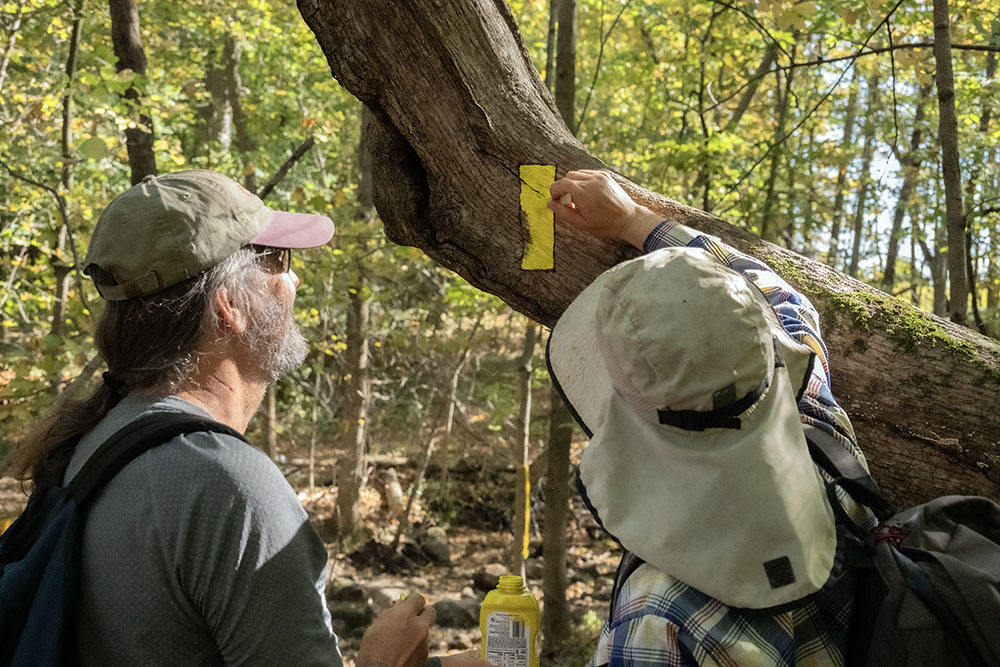
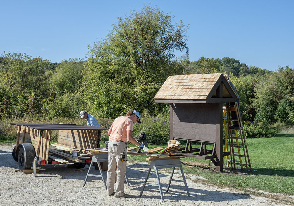
One of the two new sections runs through the well-established, 128-acre Fox Hill Nature Preserve, piggy-backing on existing trails. The work there involved mainly removing rocks from the tread (the surface of the trail) and clearing brush encroaching from the sides—along with adding trail blazes (the distinctive yellow, rectangular trail markers) and signage. Hikers on the refreshed trail can enjoy a magnificent microcosm of glacial topography, including rolling moraines, kames, native prairie, and ephemeral wetlands.
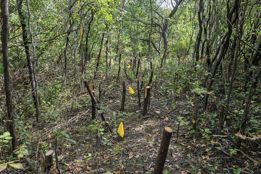
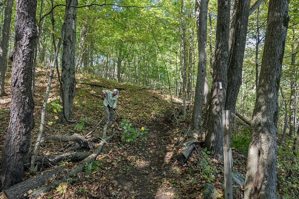
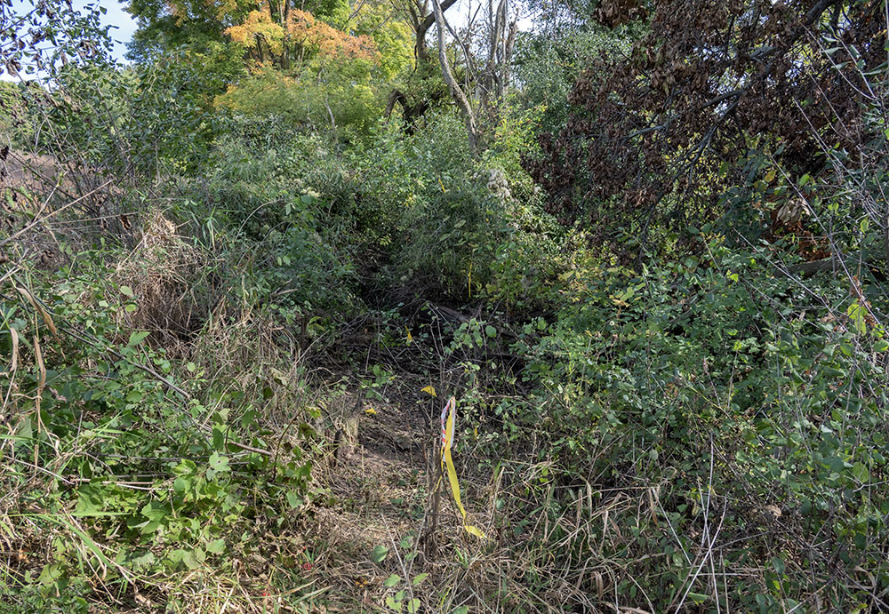
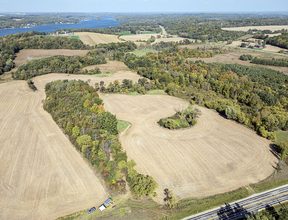
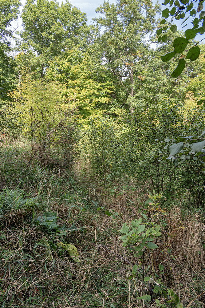
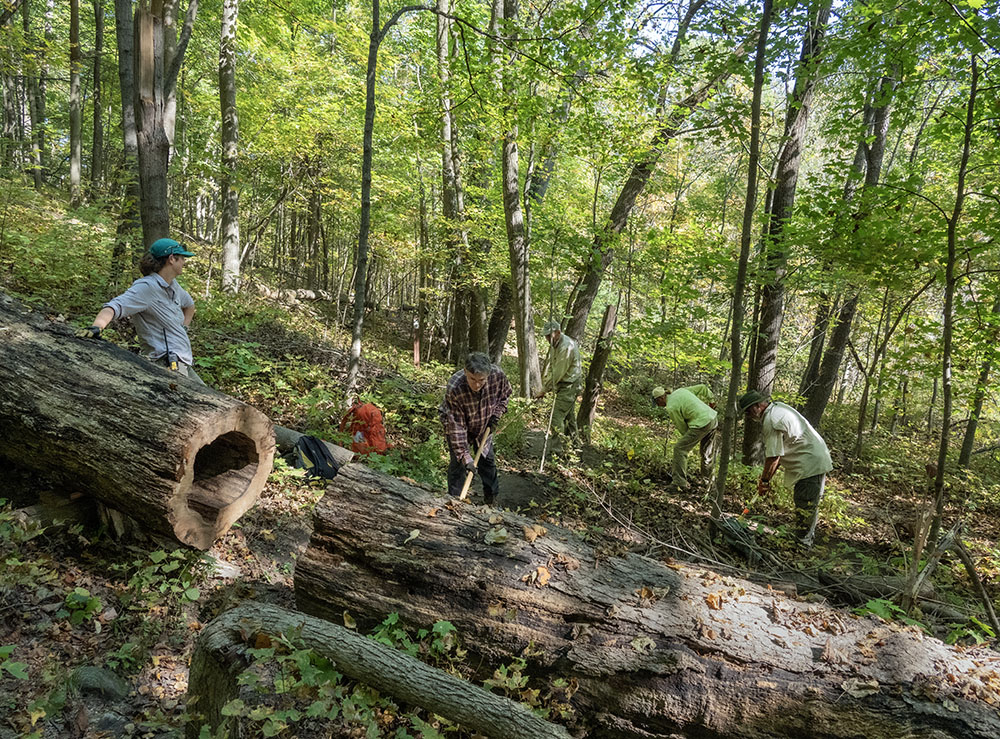
It is the second of the two new sections, known as the Hembel-Lidington Propery, that required a monumental effort, carving a trail out of trackless wilderness. Admittedly, it is a narrow wilderness, confined over about half its length between actively farmed soybean fields. That didn’t make it easier to construct. In fact, the narrowest part of the trail corridor, essentially a ditch between two fields, involved cutting through the worst tangles and impediments. Volunteers dubbed it “the jungle.” This one short portion took all four days to clear and finish.
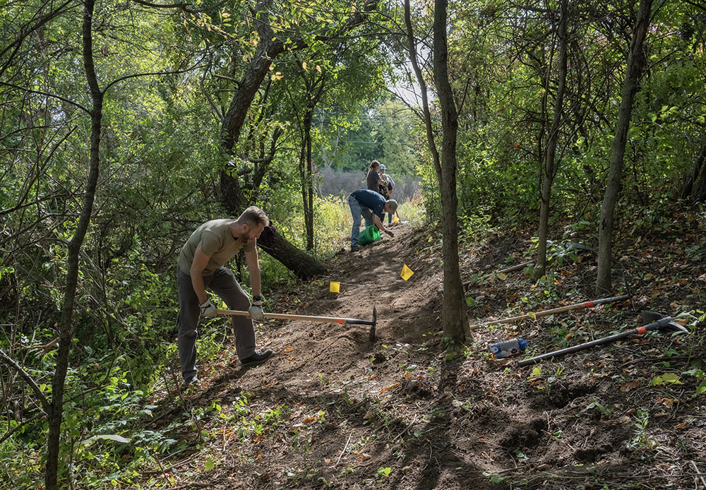
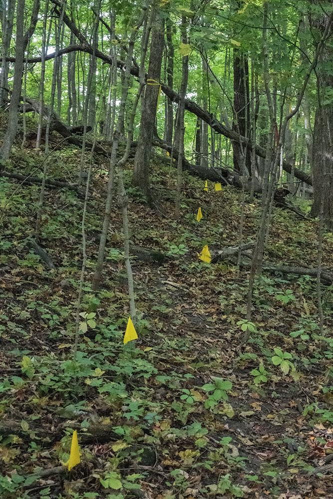
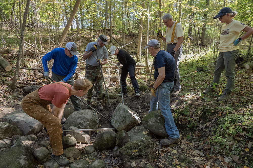
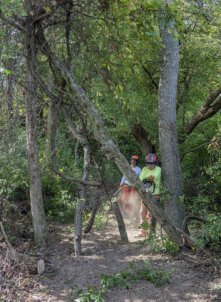
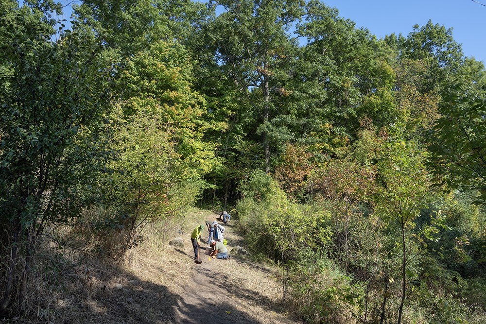
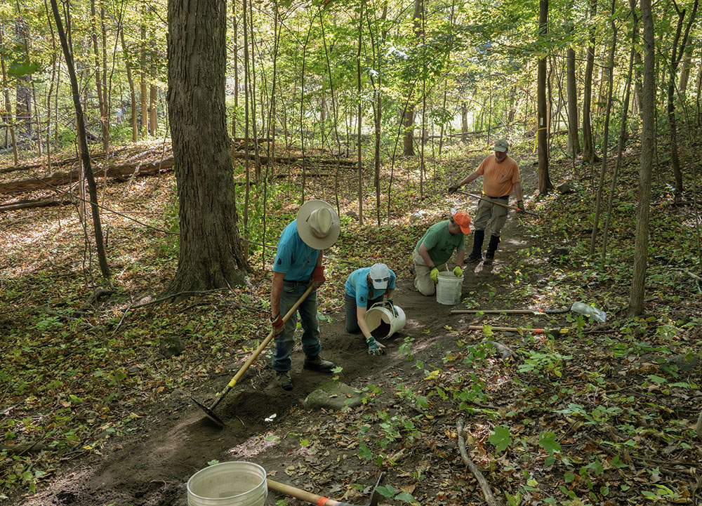
Overall, the effort involved an impressive amount of coordination. On any given day up to 70 volunteers had to be directed to do a variety of tasks. The work was done in teams of seven or eight in 200-foot sections. The path of the trail had previously been identified and marked off with yellow flags. Using distinctive firefighting tools, such as the McLeod (a hoe-like tool with an end combining a rake and a scraping blade) and Pulaski (a combination hoe and ax), the trail was cut into the dirt to create a level tread along the contours of ridges and hills. But before that could be done, trees and underbrush had to be cleared out of the way. Rocks had to be excavated, stumps pulled, roots cut away from the tread.
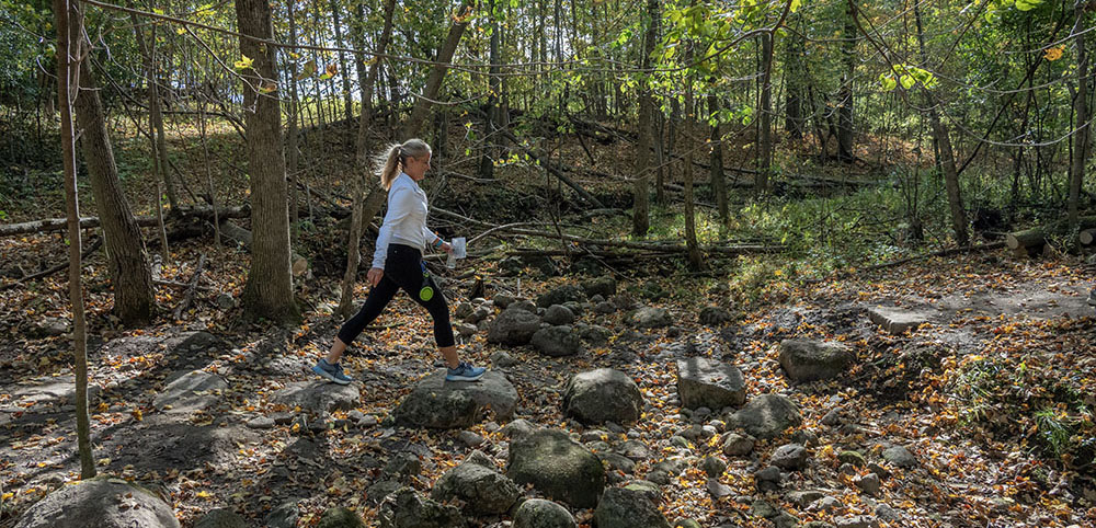
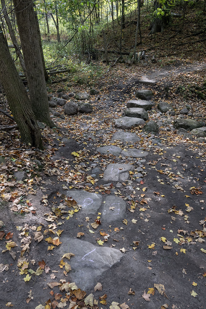
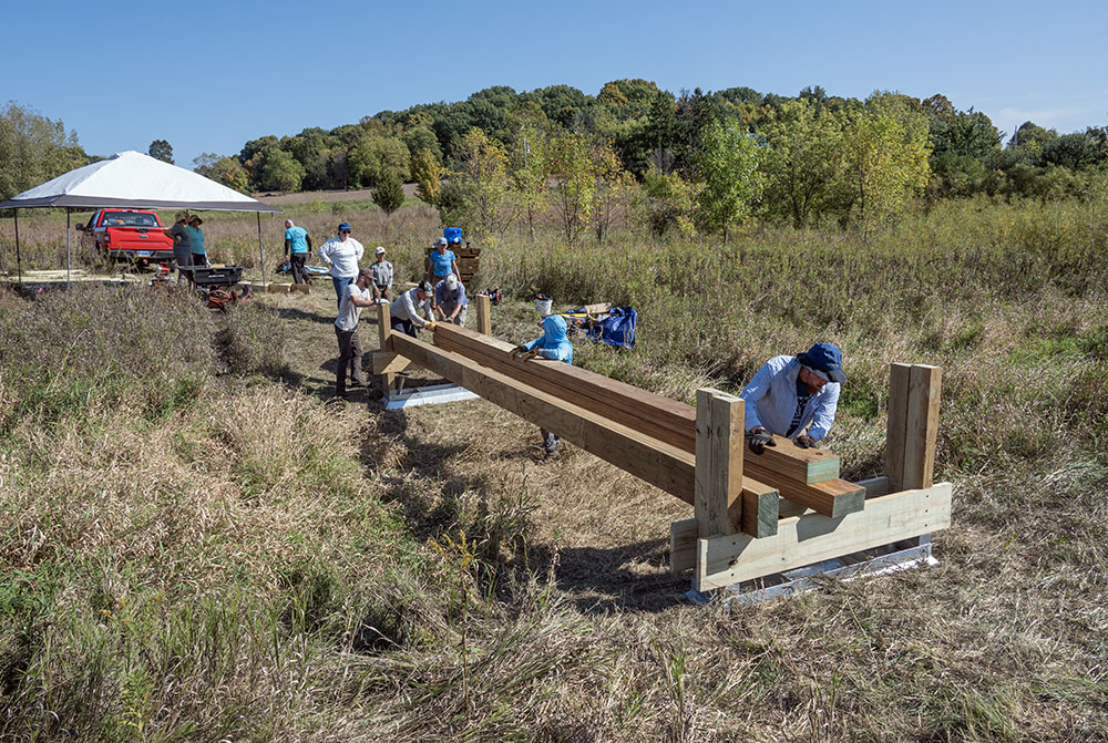
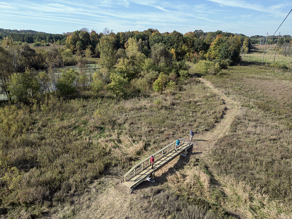
Special attention and particular skills were needed where the trail would cross three ravines of differing sizes. The widest required building a 24-foot long footbridge across a drainage ravine in an open patch of prairie (see photos below). The smaller ravine crossings were solved using stepping stones, which is a simple concept but, as I learned, a very complex construction problem. First, after establishing the location of the ford, appropriately sized (meaning massive) rocks had to be found not too far from the site. Each had to have just the right shape and at least one smooth surface. They had to be quarried out of the ground, manhandled onto a trolley and rolled to the edge of the ravine. Then the heavy rock was rolled onto a sling, lifted by several strong volunteers, and placed in its assigned position. This usually involved digging a hole to a precise depth to accommodate the peculiarities of the rock.
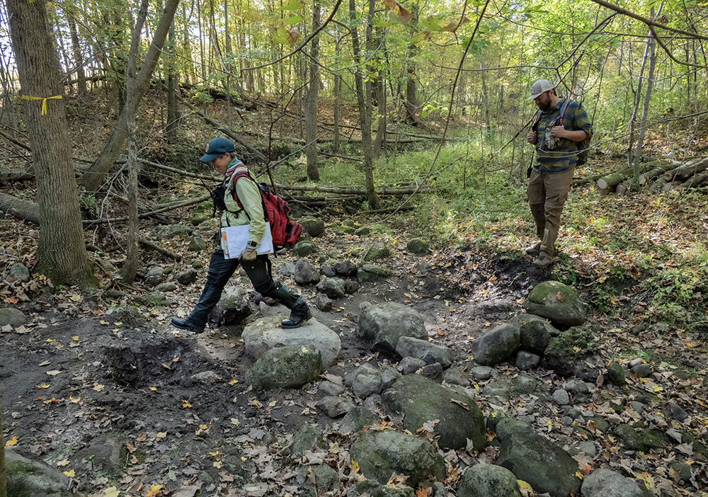
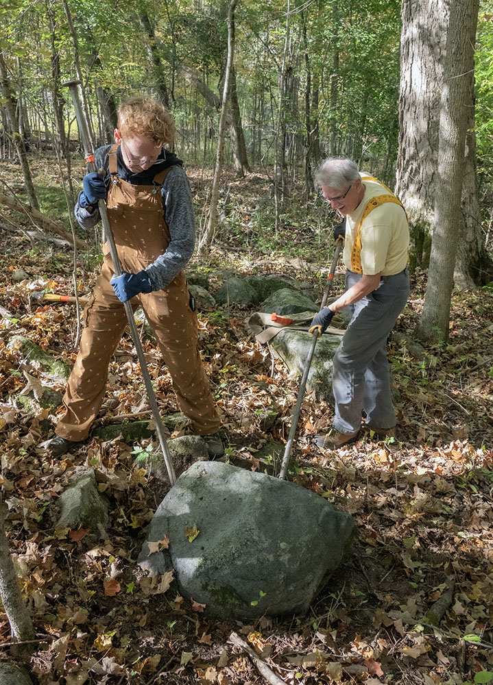
But wait, there’s more. No matter how carefully the crew placed the rock in position, it always had to be adjusted and aligned so that the flat surface would match all the other rocks. Using long, sturdy steel tamping bars (with a chisel end) or rock bars (with a pointy end), a team of four or five, directed by an experienced supervisor, levered each unwieldy rock inch by inch until it was in perfect alignment, straight and level. The wider ravine required six of these massive rocks and took the entire four days to complete—as did the wooden footbridge.
Both of the two properties through which the new trail passes, Fox Hill and Hembel-Lidington, are owned and managed by Cedar Lakes Conservation Foundation, one of Wisconsin’s oldest land trusts. The 135-acre Hembel-Lidington Property, until now not open to the public, includes mature hardwood forest, prairie and wetland, along with a significant amount of conserved farmland. The latter is being tilled using regenerative agricultural practices, which are intended to restore soil and improve ecosystem health.
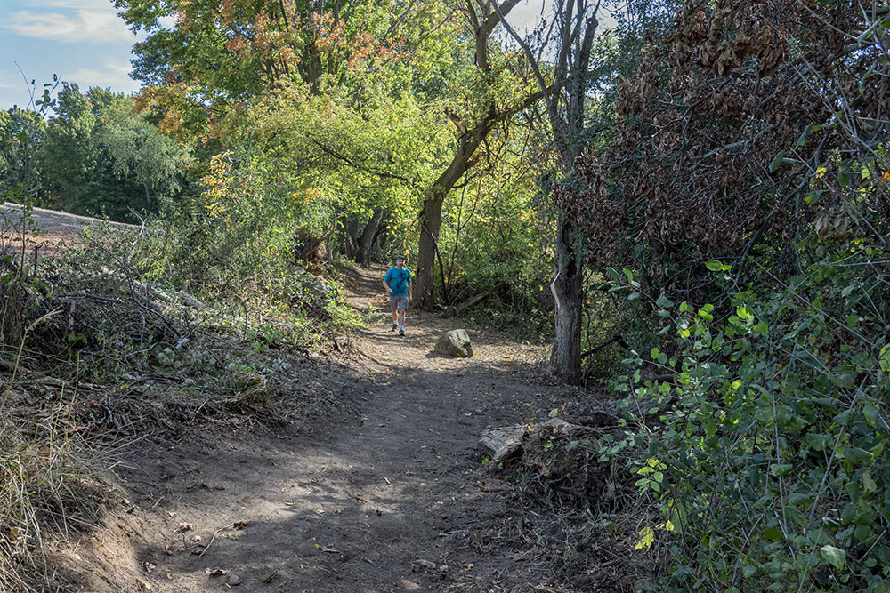
The project had been scheduled to run from Oct 1 through Oct 5. However, when I showed up on Oct 5 to document what I thought would be the finishing touches, I discovered everything packed up and gone. The trail was completed ahead of schedule, an impressive accomplishment. Autumn was already decorating the trail with falling leaves, making it seem even more natural. And, significantly, when I walked the length of it again, I ran into several people who were already using the trail. One couple walking their dog said that they are neighbors of the trail out for a first look. Two trail joggers whipped by me.
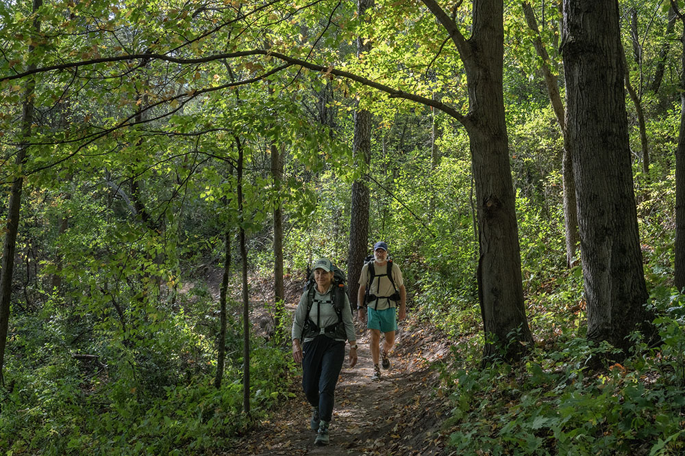
But the icing on the cake was when I bumped into Michele and Galen, a retired pair of through hikers who had gone about three-fourths of the 1,200 miles from St Croix Falls to Potawatomi State Park. Kudos to them for inaugurating the spanking new trail! And kudos to the many people responsible for making it happen.
If you want to walk the new trail, use the Polk Kames Ice Age Trail parking lot at 4695 County Hwy NN, Slinger, WI 53086. Walk a couple hundred yards east on NN. Fox Hill Nature Preserve has its own parking lot at 4214 Sleeping Dragon Road, West Bend, WI 53095.
For a more complete account of the Ice Age Trail construction project you can see additional photos in my Flickr album.
Related stories:
Celebrating the Ice Age Trail in Southeastern Wisconsin!
Autumn Splendor on the Ice Age Trail – Milwaukee River Segment!
Ice Age Trail: Stroll Along the Bark River in Hartland
Ice Age Trail: Points of Historical Interest in Waukesha County
Hiking Hartland Marsh and the Ice Age Trail
Note: Thanks go to the Ice Age Trail Alliance and Cedar Lakes Conservation Foundation for providing many of the factual details for this story.
Eddee Daniel is a board member of Preserve Our Parks and a member of the Ice Age Trail Alliance.
About Preserve Our Parks
Preserve Our Parks, Inc. is an independent nonprofit organization dedicated to the preservation of parks and green spaces. Our mission: To advocate for and promote Milwaukee area parks and open spaces and to strive to protect the tenets of Wisconsin’s Public Trust Doctrine.
For more than 25 years, we have been a leader in advocating for the protection of Milwaukee County park lands, halting many proposals to develop, privatize, or sell local parkland and lakefront spaces. More information about POP, including past accomplishments, is available at www.preserveourparks.org.
7 thoughts on "New section of Ice Age Trail now open in Washington County!"
Comments are closed.
This trail completion saga is utterly inspiring! Who knew transforming a jungle and crossing tangles and impediments could be so… organized? The sheer coordination required, with up to 70 volunteers wielding McLeods and Pulaskis like seasoned pros, is truly impressive. Building that footbridge and aligning those massive stepping stones looks positively Herculean – I bet even Odysseus would have sighed at the logistics. Its wonderful to see the trail finally open, though I feel a bit guilty about already wanting to plan my own refreshed trail adventure. Kudos to all involved for turning what volunteers aptly called the jungle into a glorious, if slightly rock-heavy, addition to Wisconsins stunning glacial topography!
Many Kudos to Eddee for sharing the beauty of Nature and of human energy with each of us.
Big improvementand a lot of work to achieve it! I hiked that area of the IAT a few years ago in my quest to complete the whole trail ( on the mulit-year plan).
Fascinating and ambitious project and an amazing chronicle of the project in both words and photos.
Wonderful piece about a wonderful feat, Eddee. Thank you!
Thanks Roger. Nice to hear from you. If you start at St. Croix Falls you could walk to the new section of the trail in a couple of months!
Really interesting piece – especially seeing the work involved in placing the step[ping stones.