An historic tour of Sanctuary Woods
June 30, 2020 | Topics: Places
By Jonathan Piel
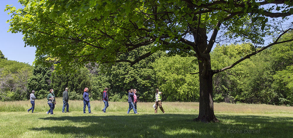
Nine of us gather in the parking area that is located in the geographic center of the Milwaukee County Grounds, conveniently adjacent to County Grounds Park, one of two enormous flood detention basins, Sanctuary Woods and an historic paupers’ cemetery. In fact, the whole area is historic, as we shall see. My purpose in leading a series of hikes here is to share this fascinating history with local community members.
We begin the tour with a bit of recent history: The 55-acre County Grounds Park was carved out of the middle of the County Grounds in 2007 after a lengthy battle to save the land from development. Sanctuary Woods, just to the east, was not included at that time. In 2019, after another protracted debate about appropriate land use, County Grounds Park was expanded to include Sanctuary woods. Suddenly the park grew from 55 acres to 112 acres. Friends of County Grounds Park, a group dedicated to protecting and improving the park’s natural areas and wildlife habitats, was also established at that time.
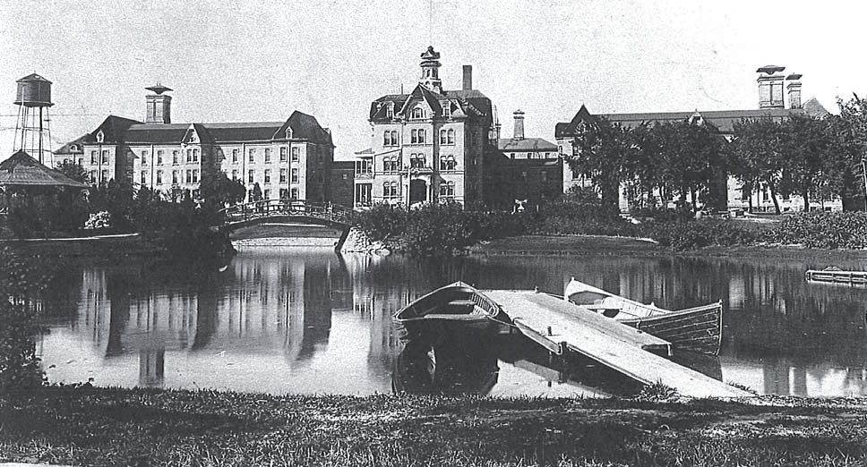
The Milwaukee County Grounds has been a County property since 1878 when it was purchased from a farmer named T.B. Hart. The location was ideal for a new mental health hospital because it included artesian spring water for infrastructure, already tilled farmland for sustenance, and an old-growth forest for recreation. That combination of resources helped the hospital be self-sustaining for nearly 100 years while providing a place of healing for patients then—and a refuge we can still enjoy today.
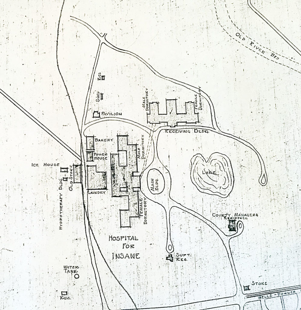
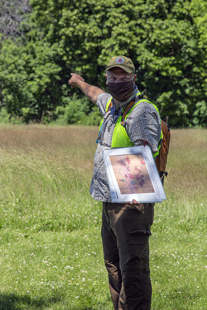
The tour takes participants on a mile-long looping hike retracing the infrastructure and introducing some of the people who defined that space. At several points along the way, hints of former roads and driveways start to appear with the positioning of trees and displaced curbs. At each stop we make I share historic photos or maps that show how the space looked in earlier times. Some are included here as well.

Over many decades the landscape benefitted from aesthetic improvements. These often were made by patients, for patients. This included a 6-foot stone dolphin urn carved by a patient named Jonathan Kocourek, who was also a Bohemian stonecutter. The urn still stands today in the parking lot at Ronald McDonald House, overlooking the woods. It is inscribed with the artist’s name and the year 1908, when it was created. The sculpture is said to have inspired patients’ recovery in the decades that followed.
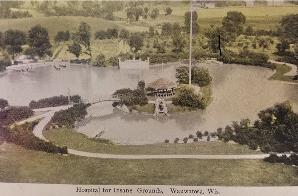
When we reach the large, open field behind Ronald McDonald House we all try to envision a 1.5-acre lake here. When the asylum was active it featured an island with a waterfall fed by one of the artesian springs. Since filled in, this lake allowed for boating and swimming recreation for the patients. However, hidden amongst some shrubbery, we find hidden remnants of the original waterfall that match the vivid color photos.
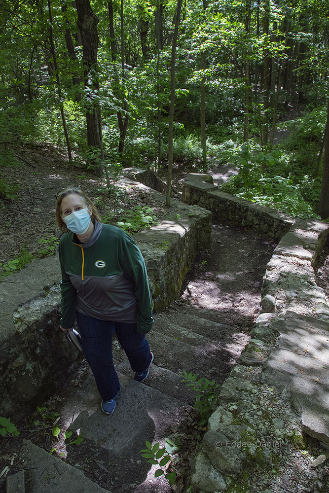
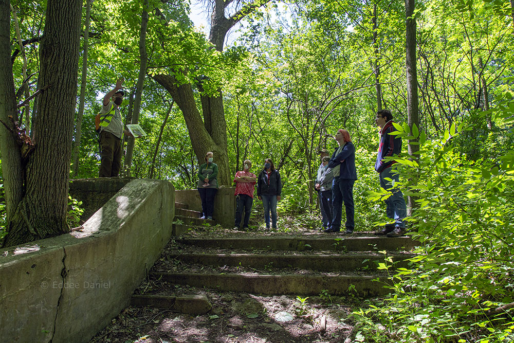
In the woods nearby, we also rediscover the ruins of patient-constructed esplanades with balustrades that once overlooked the lake, as well as sunken gardens, a lily pond, a lion statue, and a natural ravine. The ravine is in what was then known as the “Women’s Grove.” It was beautified with fieldstone staircases that led patients down into the bottom of the ravine and then back out. We take the same meditative journey as did patients for many decades: into the forest, down the staircase, and through the ravine.
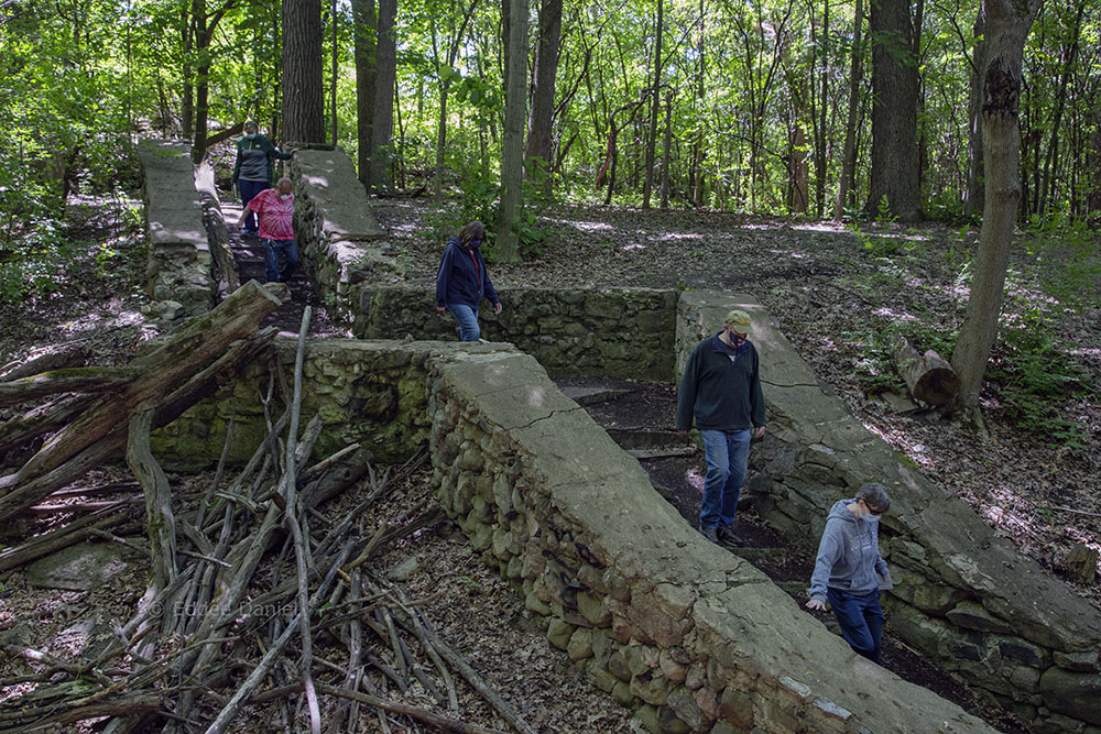
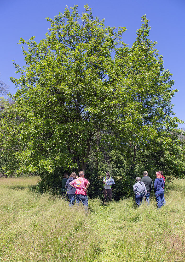
Significantly, the Sanctuary Woods that we are walking through is more than a leftover woodlot. It is a portion of old growth forest that also has been preserved. Some of the oak trees are nearing 300 years old. The lifecycle of that forest has been interrupted by the incursion of invasive buckthorn, which is abundantly clear to us as we pass through. The Friends group is methodically removing those invasives to make way for new native growth. Some of this clearing opened up a century-old structure that matches a 1916 description: “A pavilion of split-boulder construction has been erected in the men’s grove. This is not only a substantial, but very ornamental structure and will prove valuable in case of a sudden storm arising while the patients are in the grove.”
We pause our hike to sit along the remnants of the split-boulder wall that once circled the entire patio, it’s roof structure long gone. We remember some of the people who cared for patients, review the infrastructure created, the artifacts that remain, and reimagine patient journeys.

The tour ends back at the asylum cemetery where we began. Although thousands of patients were treated and released over several decades, around 200 people were interred onsite as late as the 1910s. Like so much other infrastructure, these graves were lost and forgotten for decades, but have been rediscovered. The cemetery remains a sacred place and a fitting end in tracing our modern connection to the park.
Addendum:
Early in 2020, Friends of County Grounds Park created a full year-long lineup of tours covering diverse topics like birding, botany, hydrology, mammals, cemeteries, butterflies, coyotes, fall colors, and history. Unfortunately, COVID precautions forced the cancellation of tours in April and May. However, in June a revised tour schedule resumed. It now includes more tours, for fewer participants, social distancing and recommended face masks.
For each of the tours, the volunteer guide is an expert/enthusiast in their respective areas. The goal is to enable participants to have a deeper connection to the land, the flora, the fauna, and the history of the place. This is a relatively new park and it provides wonderful opportunities to experience nature. While the 2020 format has evolved in response to the pandemic, there is a recognition that there are park elements worth preserving and celebrating for decades to come.
Additional tours available in 2020 can be seen on the events page of the Friends of County Grounds Park (FOCGP) website. You can also follow FOCGP on Facebook.
Jonathan Piel is an amateur historian and founding president of Friends of County Grounds Park. Please note: Some of the historical photos used here and on the interactive map have been found on the internet where they are so prolific and so often unattributed that it is difficult to ascribe a source. The author thanks the local historic societies who have preserved historic photos and made them available. Contemporary photography by Eddee Daniel, who is a board member of FOCGP as well as Preserve Our Parks.